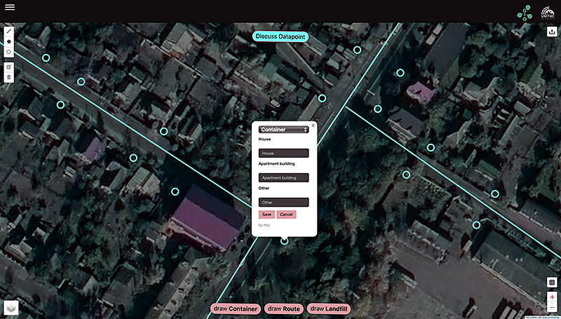
GioMap is a web-based open-source application designed for the visualization and collection of geospatial data. It allows multiple (non-technical) users to collaboratively draw and edit points, lines, and polygons directly on an interactive map in real time.
These features are automatically converted into GeoJSON files for any spatial analysis process. The tool allows uploads of existing GeoJSON files to add or edit layers.
Designed for data-scarce settings, GioMap supports efficient information gathering and response in crisis zones or areas undergoing rapid change.

Code repository
You can find the code repositoryhere.


